Wednesday, 4 September 2013

Ultra Trail du Mont Blanc

I would have loved to write a detailed story about this would-be great adventure, but I have to leave that for some day in the future. After about 30k into the race I decided for the first time in an ultra trail to abandon. I have no clue why, but both my legs where all cramped up, really just about every muscle and even walking was extremely painful and strange to do with muscles no longer working together in harmony and cramping up with every step. I had put in over 1500km of training, so I think I was well prepared, and over the coming months I will try to figure out what went wrong. All that said, the race is a great event, it is very well organized eventhough your patience is tested in some of the queues. And all that under the omni-present Mont Blanc.


Mont Blanc

The day before I had to run the Mini Trails were organized and Jordi wanted to have a go at the 1,2k run of his age group. After signing up and having received the Nº 1 bib number we first watched the younger kids running their round on the field.


Jordi's age group already had to do some serious uphill running. The picture below is just before they really start to climb.


After having recovered of the uphill and walking for a while, Jordi sprinted down and finished tired but happy.


Next up was picking up my bib number and having the obligatory outfit check. We did not really time it but I guess we were out there for some 2 hours, since most of the runners for 2 races lined up at the same time to go through the process.


After a good night of sleep race day started. It was good weather and it promised to stay that way for the rest of the weekend.

Race day... "North Face is in the air"

After dropping off my bag with things like food and clothes I could make use of in Courmayeur, just about half the race we went the starting area and met up with Andres who was already there.


We were in one of the few spots with some shadow and patiently waited for about 2 hours untill 16h30 when the race started.


As the moment gets nearer more and more people are gathering and the music is turned up louder and louder. Catherine Poletti, race director together with Michel Poletti, waded through the masses to shake hands and wish us all good luck.


With about 15 minutes to go we stand up and then on with the music of Conquest of Paradise - Vangelis we count down in french and start to run. Being in the front pack we soon could run but I maintained and easy pace, there was still many kilometers ahead.


After the first rather flat part of some 8k to Les Houches we start the first climb. Here someone spots Kilian Jornet and Emelie Forsberg and I have a quick stop to get my picture taken with these two great runners...


The uphill soon becomes steeper and I have to walk almost all of it. At this moment I tried to maintain a 31 hours schedule. Almost on the top I had a quick glance back to the Chamonix Valley.


Once passed the second control "Le Delevret" first there is a somewhat flatter part and then a really steep downhill started that was very demanding on the legs. I took it easy and many runners passed me, but I arrived in good shape in Saint Gervais les Bains. However soon after leaving that village I started to have cramps in my legs and the further I continued, in spite of this being a very easy part of the race, the more cramps I had and when I finally arrived in Les Contamines my legs were very very sore and apart from that I did not at all feel well, having nauseas and being dizzy. After resting for some 30 minutes in the medical tent I decided to not take the risk of continuing in such a bad shape and abandon for the first time. A very hard decision, but I preferred coming back stronger and more experienced over continuing with a big struggle for more than 130k with all risks involved. Meanwhile Andrés continued and he is now a proud and well-deserved wearer of the finisher jacket of the UTMB 2013. Many congratulations to him and all those who finished and to those who like me tried but had to stop the race. Also many many thanks to my wife and kids for supporting me in the months of training and before and during the race and for being there in the low moments after abandoning. For now back to training and when luck allows it I will have a second try...


After all the Mont Blanc will be there for many more years....

Wednesday, 31 July 2013

Long runs from Llança

Llança is a small town near the french border on the Costa Brava. It is known for its small stony beaches that are scattered along the coastline broken up by steeper rocks that lead right into the sea. Years ago I already ran upto the well-known monastery St. Pere de Rodes and this year I had the chance to discover more of the beauty and diversity of running through the mountains in this area.

Before going into describing a few of the runs some geography for those who want to visit the area or have already been there and to get an idea of the elevation.


North of Llança upto the french border


Just south of Llança the St. Pere de Rodes area and Serra de l'Estela


Southeast of Llança the National Park Cap de Creus

The routes shown and described below are the following:

Llança - Puig d'en Jordà - 33k - 4 to 5 hours
As can be seen the area north of Llança is dominated by the the border mountain range north and a double mountain range on the west with some lower ranges going up from east to west. Both wide easy paths and more narrow and sometimes overgrown paths can be taken here leading to the same point with different difficulty.

Llança - St. Pere de Rodes - 15k - 2 hours
This run has some rather steep slopes even on the GR11 route. From the monastery many option are open to go in other directions. The paths are well maintained, though rather technical at some stretches.

Llança - Puig Vaquer - Serra de l'Estela - 12k - 2 hours
This run is mainly along very narrow not so much maintained paths, so wear long pants or be prepared for some scratches. It also has some very steep slopes.

Llança - Cap de Creus - 43k - 5 hours
Just a beautiful run along well marked and well maintained paths with rather easy climbs in it and many options to vary the route.

Going to France

wikiloc - Llança - Puig d'en Jordà (737m)

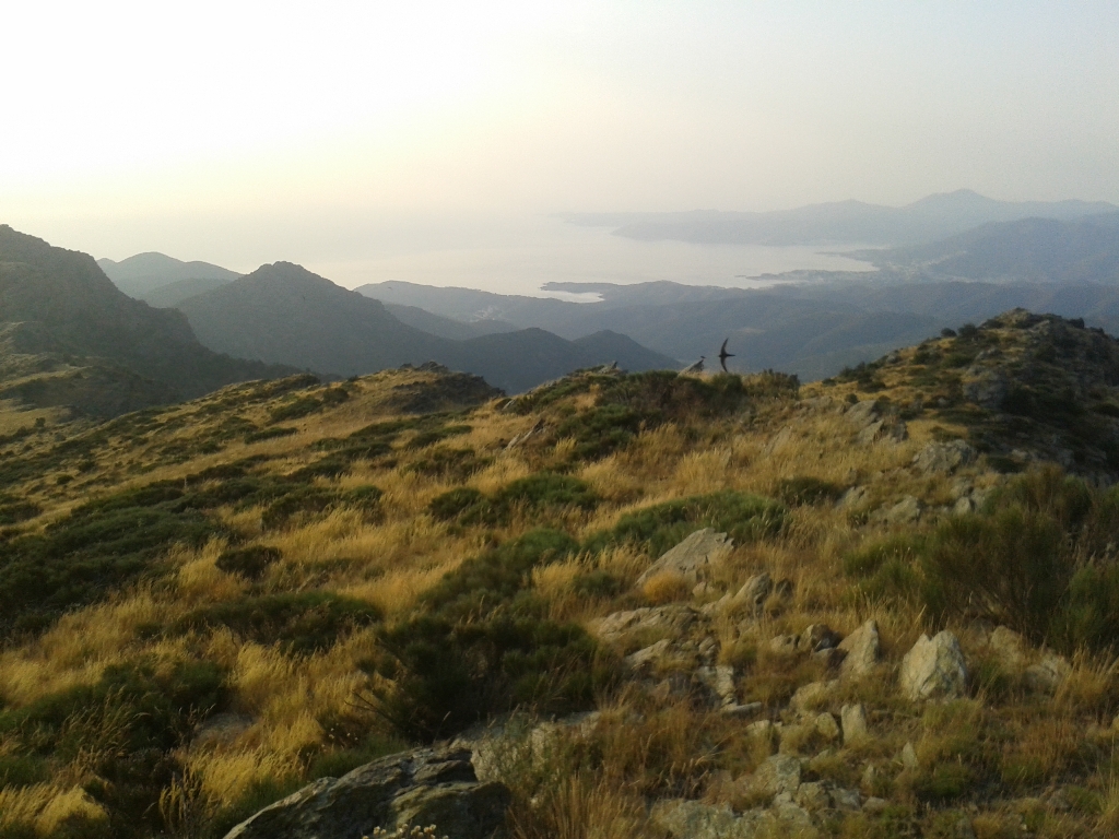
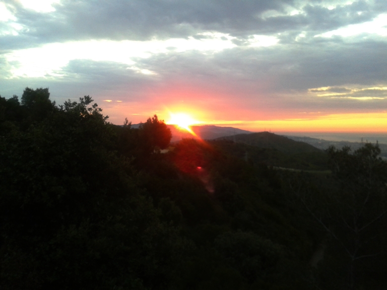
I got up before dawn and soon left Llança crossing underneath the railway up to Coll de les Portes. The first part is a very wide path that goes steadily. At the base of the Puig Tifell (409m) I looked for the way straight up but the only clear path took me around. The next top in the range is Puig del Llop (454m). The narrow path that goes over the top is rather steep both up and downhill. Just before halfway a path goes left taking you around to the base of Puig d'Esquers(606m). Here you can choose to go steep uphill and climb Puig d'Esquers or go right and around which is much easier and probably quicker to advance. On the stretch to St. Miquel de Colera, a small roman church, the sun came out playing with the clouds, the sea and colours.


Depending on the time of day you can see St. Miquel de Colera from far away on the slope of the mountain...

St. Miquel de Colera

or you have to really run up to and see it from up close, which is well worth it and it will take you less than 5 minutes to get there and back.

St. Miquel de Colera

The path continues going slightly up untill Coll de les Artigues. There is no path straight up to Puig d'en Jordà, so I took the narrow path to St. Quirze de Colera a big roman monastery behind the range of mountains on the picture below. This path takes you the more easy west slope. I guess at times it can be hard to run here. I got lucky since it seemed they had been doing maintenance only a few days ago. At some point really near a fountain it seems the path has disappeared. The area near the fountain is really wet and swampy and with some difficulty I find back the path again. It actually goes up just before the fountain but there are no indications here.

 
Coll de les Artigues

Nature as always is beautifull


And soon I am on the french-spanish border near the goal of this run. Puig d'en Jordà itself is just left from here, but for some really nice views I first went right

Coll del Teixò

I took my time here to rest and enjoy the views and the silence of some birds, bees and a ligth breeze.

Early morning sunshine

Thorny and beautiful


View of Llança and Cap de Creus

The ridge that leads up to here

The actual Puig d'en Jordà from his "twin"-summit

On top of Puig d'en Jordà

The best views of the St. Pere de Rodes Monastery


wikiloc - Llança - St. Pere de Rodes

This route is partly following the GR11 that starts near the local footbal field. The first part is a wide path full of loose stones but with an easy uphill overall to Coll del Perer. Instead of following GR11 here I went down to a small village called la Vall de Santa Creu. The descent is steep and rocky and once in the village passing a small bridge to the right the from time to time steep climb to the St. Pere de Rodes Monastery starts. In my opinion this routes gives you the best views of both the monastery and the ruins of the Sant Salvador Castle above it.

St. Pere de Rodes Monastery

For more longer runs you can go up to this castle and down along the ridge or just go down to Port de la Selva or la Selva del Mar. You can also down to the other side or like I did go right and go back by the GR11 path. The first part is almost flat on a paved road and then continues on a wide well maintained path untill it goes down very steeply back to Coll del Perer.

Llança Xtreme


wikiloc - Llança - Puig Vaquer - Serra de l'Estela

This training run is excellent for some extreme uphill training. After going up to the neighbourhoods Cau del Llop and Super Ferrer you will find a narrow path on the right that goes up just along the edge of town. Even if it looks like it is not there persist and you will eventually pass the last house and be on a more marked though still narrow path.

Llança from the slopes of Puig Vaquer


Port de la Selva

The path to the very top of Puig Vaquer was totally overgrown when I was there, so I tried to push through the bushes for a while, but since I was wearing short trousers I certainly would have my lower legs full of scratch wounds before making it so I turned back and headed for Coll del Perer and went up the steep slope and once up I went right to explore new territory. The first part is over a very wide path that goes slightly down first and steep down later on untill you can go right again onto a narrow path from time to time overgrown with bramble bushes.


At some point having come back to the seaside of la Serra de l'Estela I went left and ended up running a few hundred meters alongside the N260. I recommend going in direction of Mas d'en Gifre and make it a full trail training round.

The long and winding road to Cap de Creus


wikiloc - Llança - Cap de Creus

I got up very early and started easy along the Cami de la Ronda to Port de la Selva. The picture below is taken another day, it was too dark to make pictures, but this way you get an impression of the path.

Cami de la Ronda

In Port de la Selva I made a slight mistake going right where I should have gone left for the shortest way, but anyway, soon I left town and entered the National Park Cap de Creus. Slowly day was breaking and by the time I passed Sant Baldiri I no longer needed my headlamp.


Sant Baldiri

The area is has much more forest than I expected and only when coming to the very end of Cap de Creus the vegetation mainly consists of bushes and herbs.

The landscape of near Cap de Creus
 
Lighthouse with backlight

The last part to the firehouse of Cap de Creus I ran over the paved road. The area near the lighthouse is nice to walk around too, but I saved that for another day.

The lighthouse from up close

With the sun still behind the rocks the many sculptures people made here stood out sharp against the sky.

Rockpile-creativity

After making it to the outmost point of the rocks I took a pictures of myself with the firehouse in the background, a bit skew by lack of a photographer at that time of day and only inclined rocks nearby.


After a last pictures of one of the nice bays near the lighthouse I headed back at a somewhat higher pace now I knew what to expect.


And soon I was back at Cami de la Ronda with Llança in sight from the harbour of Port de la Selva.

Port de la Selva harbour and Llança in the background

Sunday, 16 June 2013

Long runs in Collserola

Between Friday and today, Sunday, I decided to do long runs along the track of the Collserola Mountain Marathon. During my first try I missed a critical trail and headed in a different direction and decided to continue the adventure and just learn about a new part of this beautiful training ground. Since summer has finally arrived both days I left home early to avoid the heat and sunshine.

On both days I started from home and joined the marathon trail near the Tibidabo. It is always nice to have a new day start with a beautiful sunrise.


 The beginning was familiar ground for me since I have run there many times, though it is always a pleasure to run here since it is a more humid and more fairytale kind of forest.


After a long mostly downhill stretch I arrived in the area near Sant Cugat where a famous pine tree, el Pi de Can Xandri is marking the landscape with Montserrat in the background.


Just at this point the trail turns left and goes along a corn field and here I made the mistake the first day. The trail is marked quite well with green arrows, but not here so I missed the right turn more or less half way of the field and continued straight onwards to Sol i Aire and les Planes crossing underneath the highway to join the marathon trail going up on Cami de Can Balasch. Today I took the right turn and if you look carefull enough the green arrows guide you well enough from there onwards.


 Part of the trails are wide and easy to run, but there are also long stretches of stony "canals", very narrow paths that are carved out by rain water over the years. At some point just passed a paved road called, La Carretera de la Arrebasada, some green arrows indicate to go left, the path is hardly to been seen here, but going left through the pine trees somewhat further down the path becomes more clear.


The only other point where I missed the green arrows at first is just passed Can Flo in La Floresta where you have to climb up this steep hill, cross a street and continue the climb a while more to find more green arrows to indicate the way.


Soon after the trail goes winding through a very nice area, with great views of the surroundings and at some point you can see Montserrat again far away, with a faint rainbow on the left in this picture.


After entering La Floresta again and running along the edge of this area of houses scattered on the mountain side I crossed the highway high above this time and soon I started the long climb to Castellví along the trail I mentioned earlier, Cami Can Balasch. I will repeat the trail again some day soon and do the full marathon from its original starting point and time it to compare my training pace to the race pace of October last year.

Sunday, 9 June 2013

Cursa La Maquinista - 10k

Today the 12th race of the Barcelona Challenge 10k. I did not as well as I hoped for finishing in 38m56. I guess that after two weeks of more than 100k mountaintraining each and one week of normal 10k training the body is not ready for the full 10k at my highest pace.

The day started with no clouds to be seen like yesterday when we had some very heavy rain in the morning. Eventhough it was not warm yet, it might be very quickly. I arrived in the start area well on time and around 8 o'clock I handed in my backpack and started my warmup. Just before 9 I entered the red box and waited to be shot away. The first kilometer was quick in 3m33 and the second was exactly on the 37 minutes schedule in 7m24. The third kilometer had a climb in it but I still passed in 11m00. Maybe I should have done the climb a bit more easy. In spite of passing the 4k marker exactly on schedule for 37 minutes in 14m48 I felt I was getting tired already and on to the 5th kilometer I dropped pace to pass in 18m40. It was starting to be very warm and the 6th and 7th kilometer went slow and the 8th with the uphill I was running above 4 minutes per k. I braced myself for the last two kilometers and sprinted the last part to the finish to stay within 39 minutes.

This race concludes the Barcelona Challenge 10k 2012/2013. It has been fun to run all the races and also in doing so I gathered enough points to be second in the ranking of my age group. I am certainly not the fastest, but running all races gave me the points I needed. After the mountain season I will get back to the shorter distances on the road, though next year I will not run all 12 races and I will have a go at 5k and maybe even shorter.